| Overview - all events | Frameless version of this page |
The prediction of the partial occultation
Year  M  D  h  m  s  Event Type     Ph   Dur dMag  %Ill   Sep  PA  MinD      h  m  s   h  m  s   h  m  s   h  m  s   h  m  s   h  m  s   h  m  s
2009 10  3 18 30  0  (I) occ (II)    P   371  0.2  84.1 130.1  71  0.604 |            18 26 54            18 30  0            18 33  5
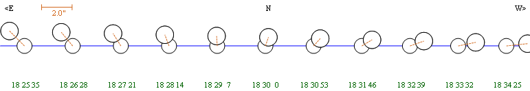
Data and diagrams created with Occult 4 from Dave Herald
Jupiter system - 2009/10/03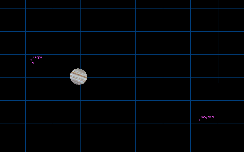
Starmap created with Guide 8 from Bill J Gray.
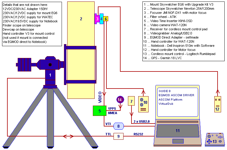
The setup for occultation recording
CCIR (PAL) full size video image 768x576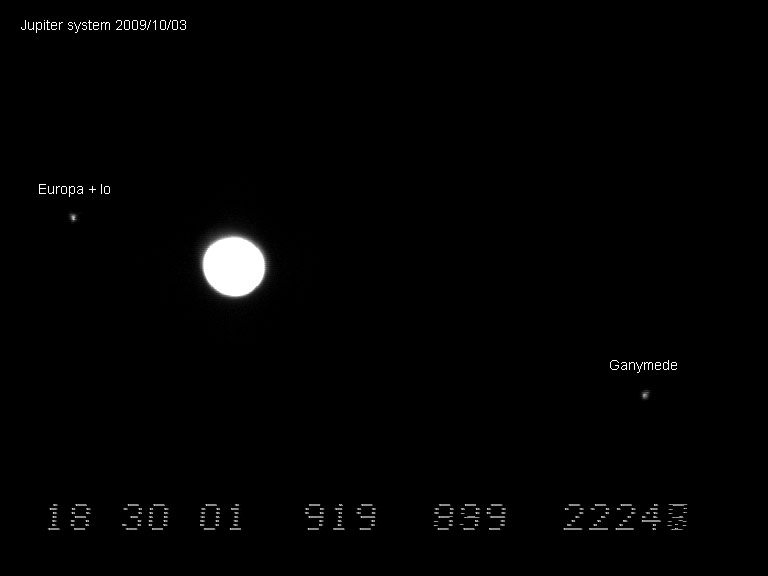
Limovie settings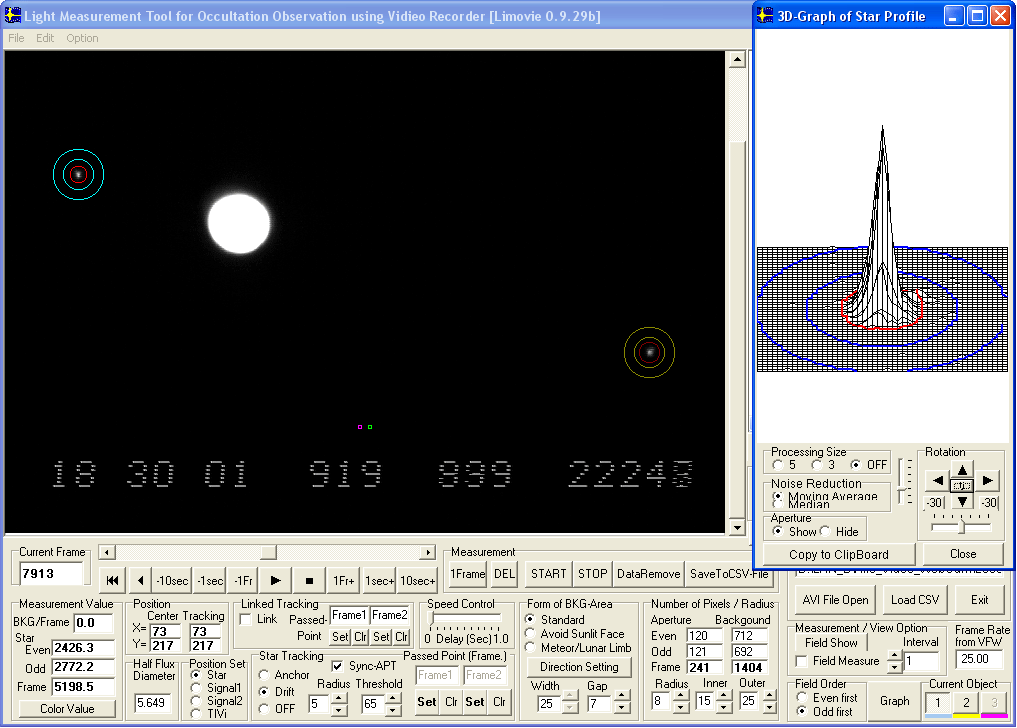
MUTUAL OCCULTATION - REPORT
MUTUAL OCCULTATION - REPORT
EAON & IOTA-ES
EUROPEAN ASTEROIDAL OCCULTATION NETWORK
INTERNATIONAL OCCULTATION TIMING ASSOCIATION EUROPEAN SECTION

1.DATE: 2009/10/03
Event: Jupiter system 1O2; Io (I) occulted Europa (II)

2.OBSERVER:
Name: Gerhard Dangl
Phone: ++43-(0)2842-53908
Address: AUSTRIA, A-3830, Nonndorf 12
E-mail: gerhard@dangl.at

3.OBSERVING STATION:
Nearest city: Waidhofen/Thaya
Latitude:  N 48 47 13.5 (WGS84)
Longitude: E 15 14 08.2 (WGS84)
Altitude:  599m         (WGS84)
           554m         (MSL)
Single/Multiple: Single

4.TIMING OF EVENTS:
Type of event:
"S"tart observation; "I"nterrupt-"s"tart; "D"isappearance;
"B"link; "F"lash; "E"nd observation; "I"nterrupt-"e"nd;
"R"eappearance; "O"ther (specify)

Recording time HH:MM:SS UTC
S:    18:24:46
E:    18:35:12

5.TELESCOPE:
Type: Newton
Focal length: 1200mm + Barlow lens element on camera = 2200mm effective focal length
Aperture: 254 mm
Magnification: video/primary focus/FOV 9.9'x 7.4' (768x576, 0.77"x0.77" per pixel)
Mount: Equatorial
Motor drive: Yes

6.TIMING & RECORDING:
Timekeeping: GPS 1PPS Garmin 18x LVC + KIWI-OSD
Sensor/Camera: WAT-120N, CCIR, 1/2" Sony CCD-Sensor ICX419ALL, GAMMA=OFF (linear)
Mode of recording: It=40ms (25 Img/s), Video CCIR, AVI, YUY2, Huffyuv,
Device of recording: TIS DFG/USB2-lt Videograbber USB2.0, Notebook Harddisk
Time insertion: KIWI-OSD

7.OBSERVING CONDITIONS:
Atmospheric transparency: bad (thin clouds moving)
Wind: No
Object image stability: fair
Temperature: 281 Kelvin (+08 deg Celsius)

8.ADDITIONAL COMMENTS:
Object height above local horizon at recording start: 23 deg
Object height above local horizon at recording end:   23 deg

Only Clear glass filter (Astronomik) for CCD protection was used.

Video evaluation accomplished with VirtualDub1.8.6, AviSynth2.5,
Limovie0.9.29b, LimovieAverage 1.2.0.0 and Excel

3-D Position and timing
Garmin GPS18x LVC
Receiving 10 satellites
Horizontal Dilution of Precision 0.9
Geoidal separation 44.5m (Altitude 554.0MSL + 44.5 = 598.5m in WGS84 datum)

Gerhard Dangl
gerhard@dangl.at
www.dangl.at/
The evaluation of the measurement data
The evaluation of the measurement data from recorded video was done with the software packages below:
VirtualDub
Limovie
Avisynth
LimovieAverage
Help text, using LimovieAverage with mutual events
Measurement data and results in csv and Excel data format
CSV file, binning 8 data points (118 KB)
Excel file, binning 8 data points (643 KB)
CSV file, binning 16 data points (59 KB)
Excel file, binning 16 data points (459 KB)
CSV file, binning 32 data points (30 KB)
Excel file, binning 32 data points (342 KB)
The diagrams in an overview
Diagram binning 8 data points - click for full size |
|
Diagram binning 16 data points - click for full size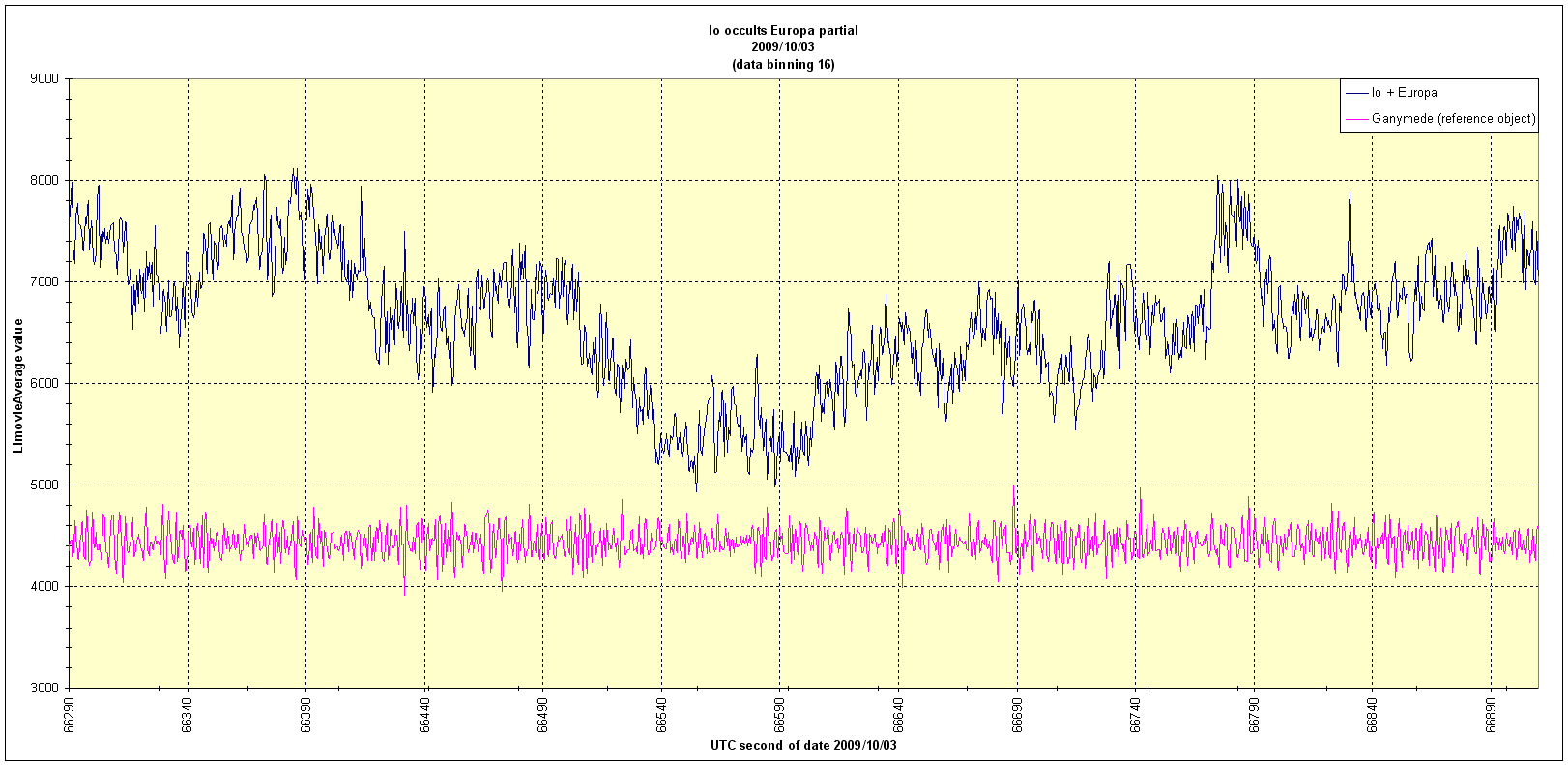 |
|
Diagram binning 32 data points - click for full size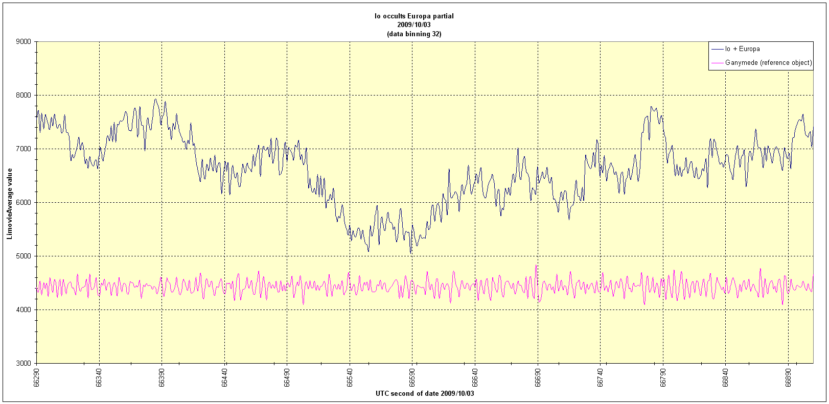 |
|
October 04, 2009 |
|
Site Home |